We offer an apparatus-and-methods complex for geo-engineering surveys that includes new modifications of geoelectrical prospecting, seismic surveys, logging, hydrodynamic formation testing, field laboratory core analysis and program-software application.
Problems to solve
- detailed structure-tectonic pattern within the nearhole and crosshole space;
- hydrogeological and ecological environment estimation;
- rock physical and mechanical parameters determination;
- rock mass physical conditions estimation;
- carstified rock and low coherence zones detection;
- gas storage monitoring;
- soil stabilization quality control (under the base of buildings and constructions).
The flexible structure of the complex depends on the problems to be solved.
Land seismics combined with pulse geoelectrical survey (time-domain electromagnetic sounding) are used in regional geotechnical surveys for large tectonic faults delineation, waterbearing stratum detection and geological cross section prediction.
High-frequency borehole seismic and seismic tomography are used for detailed reservoir mapping/nearhole and crosshole small-amplitude tectonic faults detection and rock elastic-deformation characteristic estimation through S-wave, P-wave parameters, karst-suffosion and frac zones identification.
Optimal logging complex consists of lateral resistivity logging, radiometrics (density gamma-ray logging, selective GR logging, rock natural radioactivity GR logging), caliper logging, full-waveform sonic logging, induction directional survey, spinner survey and provides lithology profiling, frac zones, prestressed rock zones detec-tion, rock quality, underground rockslide estimation, physical and mechanical parameters, capacitive-filtration properties determination.
Geology and geophysics data processing is performed via PC (with modern software for surface and downhole logging data processing and interpretation).
Features and advantages
- operational efficiency and data integrity required by designers and house builders;
- data reliability (under hostile geological conditions - upper section, soft/fractured/weathered formations etc.; under hostile technological conditions - sonic, electrical, other disturbance).
Apparatus-and-method complex can be used for: solving of petroleum and geology problems: underground gas storage detailed study; while borehole engineering under difficult near-surface conditions of dan-gerous physical and geological process; while production base designing for Shtokman gas field; rock mass structural and tectonic detailed study for Tuapse oil refinery plant.
The complex was successfully used in geotechnical investigations while subway designing in Yekaterinburg, Che-lyabinsk, Kazan; in karst phenomenon analyzing in Ufa and Kazan; in geotechnical investigations at the hydroelectric complex for Yumaguzino at Belaya river, Bashkortostan); trans-river product pipeline design-ing (Belaya river, Ufa river).
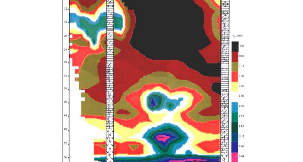
Rock massif karst estimation by seismic tomography
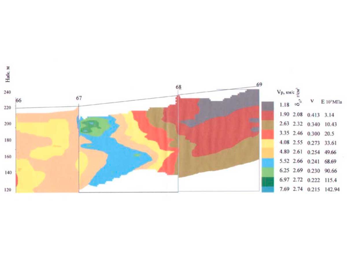
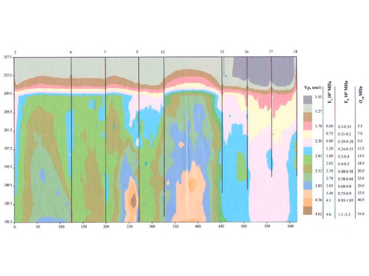
The example of geological-tectonic structure decision and rock massif elastodeformed properties estimation
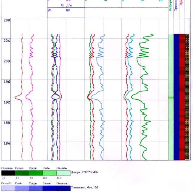
Rock physical-mechanical properties determination according to well logging (VAK, GGR-P)